Subject: Florida
Period: 1856-68 (dated)
Publication:
Color: Hand Color
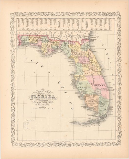
A. A New Map of Florida, by Charles Desilver, dated 1856 (12.1 x 14.6"). An early map of the state with only 31 counties organized. Settlement in the southern half does not extend below Ft. Howell, Center and Jupiter. A table at the top of the sheet shows the water routes from St. Augustine to various destinations around the state and southern Georgia. Surrounded by a decorative scroll border.
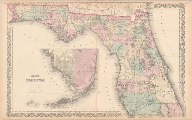
B. Colton's Florida, by G.W. and C.B. Colton, dated 1868 (26.3 x 17.0"). An attractive and detailed double-page map of the state. Development is still primarily in the northern half of the state where settlement and the transportation network continues to fill the interior of the map. The southern portion of the state is depicted in an inset on the same scale, with surveying work beginning to show along the coast of Dade and Monroe counties.
References:
Condition: B+
There is minor scattered foxing and light toning confined to the sheet edges.