Catalog Archive
Auction 160, Lot 251

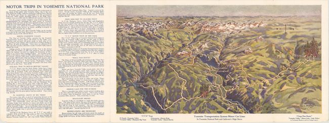
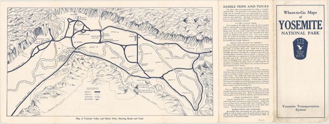
"[Brochure] Yosemite Transportation System Motor Car Lines in Yosemite National Park and California's High Sierra [on verso] Map of Yosemite Valley and Glacier Point, Showing Roads and Trails",

Subject: Central California, Yosemite National Park

Period: 1935 (circa)

Publication:

Color: Printed Color

Size:
15.1 x 8.1 inches
38.4 x 20.6 cm
Download High Resolution Image
(or just click on image to launch the Zoom viewer)

This promotional brochure contains two maps of Yosemite National Park. The first is a lovely bird's-eye view of the region and depicts the recently improved road system within the park, including easy access to Hetch Hetchy and the Giant Sequoias. The second map, on verso, shows roads, trails, streams, and buildings in outline. Accompanying text describes outings to various points of interest. Self-folding, with title on front wrapper "Where-to-Go Maps of Yosemite National Park." Published by the Yosemite Transportation System.

References:

Condition: A

A clean and bright example with a few tiny chips along the bottom sheet edge, well away from the map image. Minor soiling on front self-wrapper.

Estimate: $80 - $100

Sold for: $60

Closed on 11/16/2016

Archived