Subject: Alabama
Period: 1894 (published)
Publication:
Color: Printed Color
Size:
22.1 x 35.8 inches
56.1 x 90.9 cm
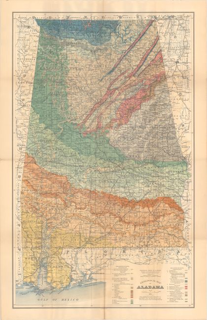
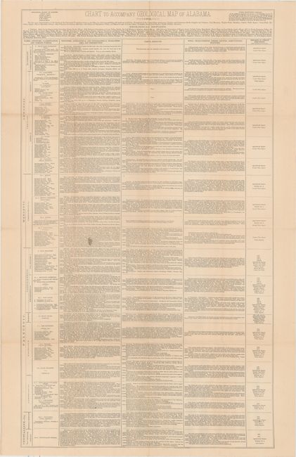
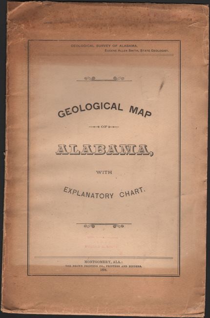
This large geological map, published by the Geological Survey of Alabama under the direction of Eugene A. Smith, is preceded only by two very rare sketch maps by Michael Tuomey, and by Smith's smaller 1878 map included in Berney's "Hand-book of Alabama." The base map was compiled from Land Office records and shows good detail of roads, railroads, rivers, settlements and towns. Of particular interest is the "Old Federal Road" shown winding its way from Columbus, GA to Mobile and provided an early route for settlers in the region. The geology of the region is overlaid on top of the map, with 12 different types identified by various color and texture. The map is accompanied by a chart of equal size describing the rock types and their distribution, fossils, soils, timber, etc. The map and chart are housed in its original paper envelope with a presentation stamp by Smith. We have found no auction records or dealer listings for this map in the last 30 years. Not listed in Marcou & Marcou.
References:
Condition: B+
A vivid example, issued folding, with light color offsetting and a short fold separation at bottom that has been closed on verso with archival tape.