Subject: Southwestern United States
Period: 1861 (published)
Publication:
Color: Black & White
Size:
9.1 x 11.8 inches
23.1 x 30 cm
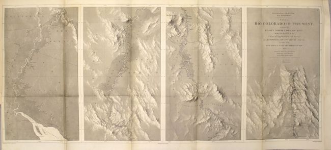
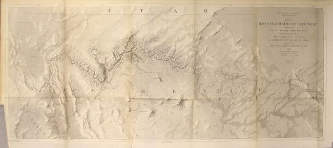
This pair of maps represents one of the most important exploring efforts of the American Southwest. Ives published his explorations in a series of four maps - these being the first two. In his book Mapping of the Trans-Mississippi West, Carl Wheat devotes several pages to these two maps saying they are two of the best created by the remarkable F.W. von Egloffstein. They were engraved using his system that imparts the appearance of depth to the topography and nearly mimics a satellite image. A remarkable accomplishment for the time. Each map measures the approximate size given.
The first map shows the topography and geology of the lower Colorado River in four panels (each about 8.5" x 14"), beginning at the Gulf and ending in Black Canyon at Fortification Rock. Locates and names Pt. Invincible, Ogden's Landing, Fort Yuma, Lighthouse Rock, The Needles, the location of Beale's Crossing, Bullshead (today's Bullhead City), Painted Canyon, Fortification Rock, and much more. Numerous rapids are noted including Roaring Rapid 3 large rocks & one sunken rock below, and Violent Rapid with rocks on both sides.
The second map details the region around the Grand Canyon and Little Colorado River. It shows the river from about Needles (Whipple's Crossing and Mojave Canyon) north through Black Canyon, to the Little Colorado and then north to beyond the survey's limit as the riverbed fades to nothing. The map locates Fort Defiance, Campbell's Pass, Zuni, Moquis (Hopi) Pueblos, San Francisco Springs (Flagstaff), Las Vegas, the Mormon Road, numerous Indian tribes, and much more. Several important exploration routes and trails are shown including The Old Spanish Trail, Whipple's trail 1854-4 and Beale's trail.
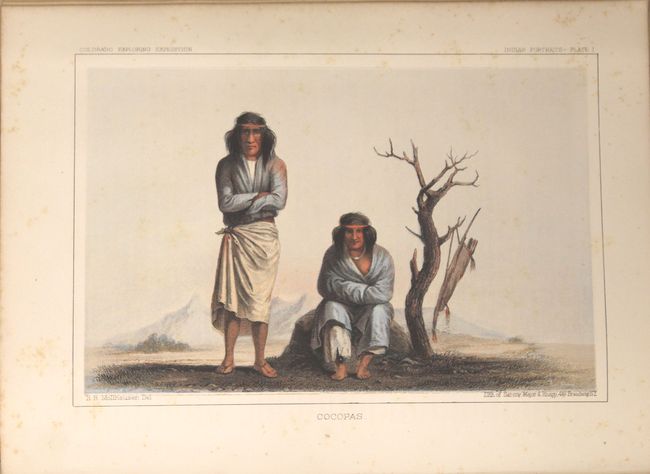
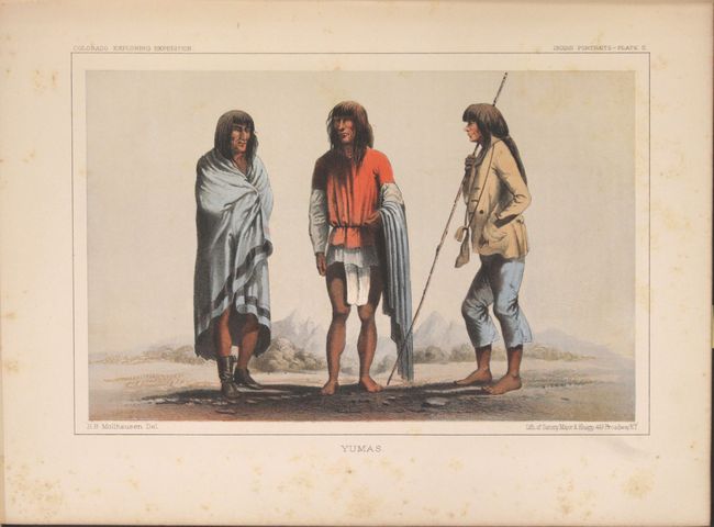
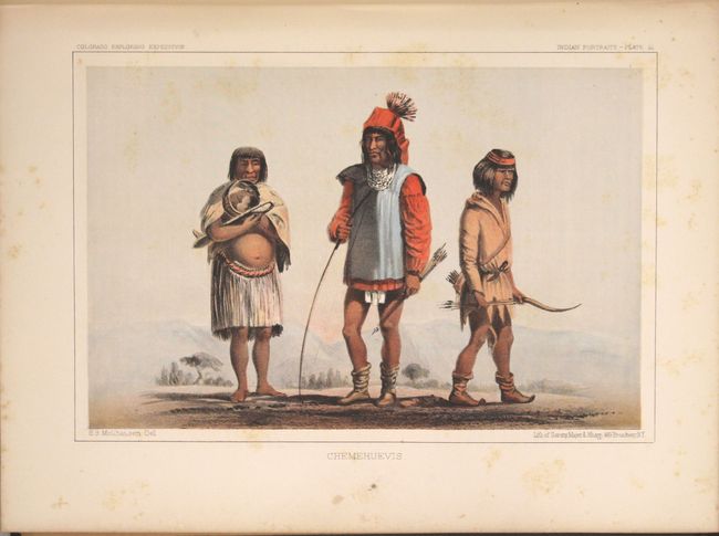
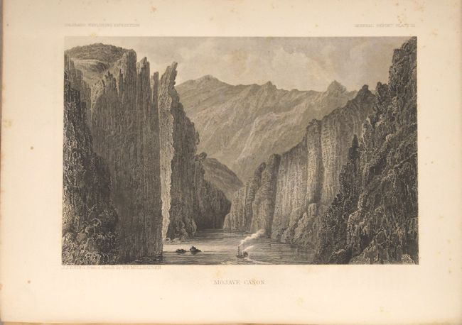
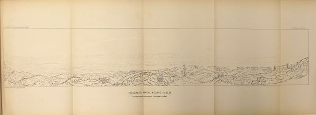
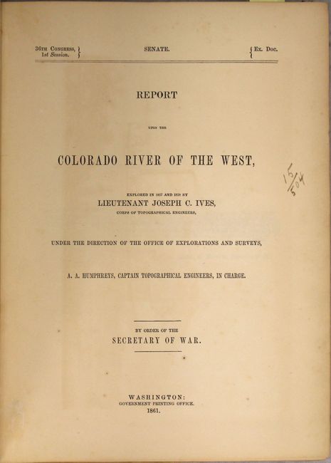
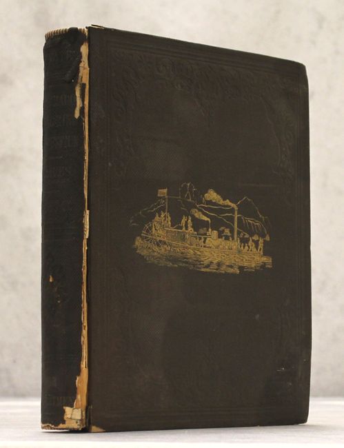
The maps are still bound in the original report. The report consists of 5 parts including a general report, hydrographic report, Newberry's geological report, and sections on botany and zoology. In addition to the 335 pp. of text, there are numerous plates of the Grand Canyon and other panoramic views along with the fascinating hand-colored Indian portraits. According to Goetzmann, "the comprehensive observations of Ives and the scientists accompanying his expedition were a distinct contribution to the knowledge of a little-known and superficially explored region." Quarto, hardbound in brown cloth with gilt illustration on front cover and gilt title on spine.
References: Wheat (TMW) #947 & #948.
Condition: B+
The maps are in unusually good condition with only faint toning along the folds. Plates are very good with light scattered foxing, and text is lightly toned also with scattered foxing. The spine and joint of the front cover is chipped and the edges are bumped and stained.