Subject: New England - United States
Period: 1795 (dated)
Publication: Historical, Geographical, Commercial and Philosophical View of the United States
Color: Black & White
Size:
18.3 x 14.3 inches
46.5 x 36.3 cm
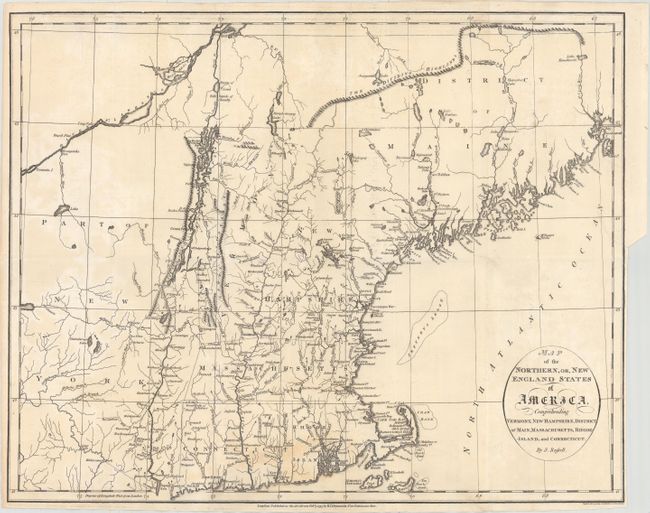
Handsome copper engraved map shows New England from Maine to Cape Cod, prior to the final settlement of the boundary between the United States and Canada. The map extends south from the St. Croix River, which is part of the eastern boundary with Canada, to Nantucket Island and west to mid-New York state. In the north the District of Maine is bounded by The Dividing Highlands (Katahdin and the start of the Appalachian Trail) whose imprecise location was the cause for friction between the US and British North America (Canada). The map shows the Highlands extending to 46 degrees North Latitude. The present border originated with the Treaty of Paris in 1783, which ended the war between Great Britain and the United States. The Aroostook War was an undeclared (and ultimately bloodless) confrontation in 1838-39 between the United States and Great Britain over the international boundary between Canada and Maine. The dispute resulted in a mutually accepted border between the state of Maine and provinces of New Brunswick and Quebec. Today, Maine extends north beyond 47 degrees. Published by William Winterbotham (1763-1829) and engraved by Russell.
References: McCorkle #795.9; Phillips (Maps) p. 472.
Condition: B+
Issued folding with light uneven toning, faint offsetting, and a bit of staining near the bottom of the map image. A 1.25" binding tear at right has been professionally repaired.