Subject: Eastern United States
Period: 1821 (circa)
Publication: A New General Atlas...
Color: Hand Color
Size:
12.5 x 9.7 inches
31.8 x 24.6 cm
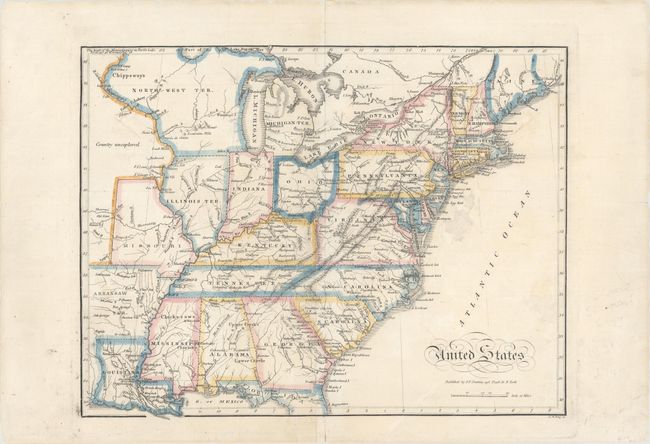
This handsome and uncommon early 19th century map of the United States was published by J.V. Seaman and engraved by G.B. King. It shows all 24 states extant at the time of publication, including the newly admitted Missouri, although it still names Illinois as a territory. The map also locates Michigan, Arkansaw, Florida, and North-West territories. Indiana and Illinois Territory appear too far to the west, putting Chicago in Northwest Territory. The westernmost portion of land is labeled Country unexplored. Roads are delineated, and numerous Indian tribes identified.
References:
Condition: B+
Original outline color with a few short tears and a hole in the unengraved area in the Atlantic ocean that have been repaired on verso with archival material. A small rust spot appears in Rhode Island, and there are some short edge tears in the blank margins that have also been archivally repaired.