Catalog Archive
Auction 160, Lot 148

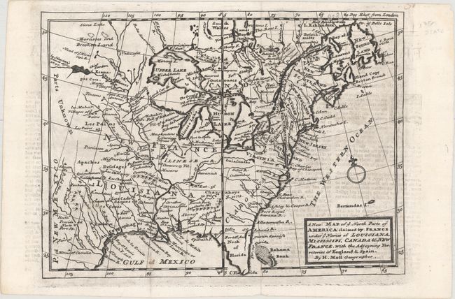
"A New Map of ye North Parts of America Claimed by France under ye Names of Louisiana, Mississipi, Canada & New France, with the Adjoyning Territories of England & Spain", Moll, Herman

Subject: Colonial Eastern United States & Canada

Period: 1735 (circa)

Publication:

Color: Black & White

Size:
10.8 x 7.8 inches
27.4 x 19.8 cm
Download High Resolution Image
(or just click on image to launch the Zoom viewer)

This handsome map is a reduced version of a portion of Moll's large map published in 1720 with the same title. It covers the same region as Moll's "A Map of New France..." It presents the British view that their colonies extended to the Mississippi River and incorporated Nova Scotia and Newfoundland. Spain controls the Neck of Florida and New Mexico, and France controls Louisiana and Canada. Filled with Indian place names and forts.

References: cf. McCorkle #729-3.

Condition: B+

A dark impression on a clean sheet with some light offsetting from an opposing page of text. Issued folding.

Estimate: $400 - $500

Sold for: $300

Closed on 11/16/2016

Archived