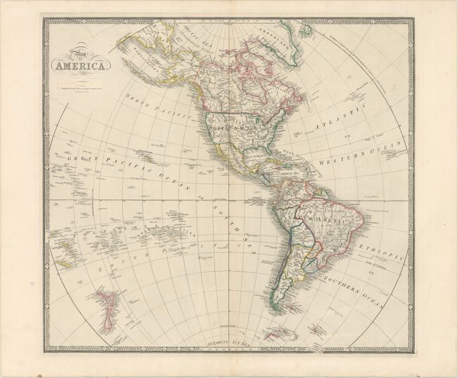
Subject: Western Hemisphere - America
Period: 1850 (circa)
Publication:
Color: Hand Color
Size:
23.2 x 20.9 inches
58.9 x 53.1 cm
This handsome map features nice detail of the hemisphere. In this edition of the map, Texas is part of the United States, and the nation's boundaries are firmly established. Oregon is named and stretches north of the U.S.-Canada border, and Freemont Pass appears in present-day Colorado. A remnant of Lake Parime can still be found in South America. The map extends through the Pacific Ocean to include New Zealand and the Pacific Islands where Hawaii is prominently shown. In the Antarctic Icy Sea, and just peeking out of the border are the South Sandwich Islands, labeled Sandwich Land and Southern Thule. Grahams Land is identified in the Antarctic.
References:
Condition: A
A nice impression on a sturdy sheet with faint toning along the centerfold. There are remnants of hinge tape on verso.