Subject: Western Hemisphere - America
Period: 1812 (dated)
Publication:
Color: Hand Color
Size:
25.3 x 21.9 inches
64.3 x 55.6 cm
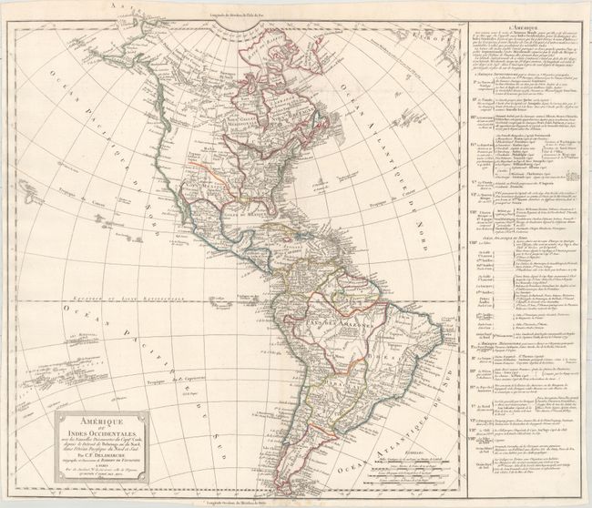
Large, handsome map of the Americas including the discoveries of Captain Cook in Alaska and Hawaii, with several additional islands depicted in the Pacific. The United States is shown confined east of the Mississippi River. The text panel at right names the thirteen original states with additional notes concerning the creation of the new states of Maine, Vermont, Kentucky, and Tennessee. The "territory" of Washington is noted as the capital of the United States. Originally by the Robert de Vaugondy family, this map was reissued by their successor, Charles Francois Delamarche. The map is based on the work of the Robert de Vaugondy family, but was re-engraved by Delamarche to incorporate the latest information gathered by the explorations noted.
References:
Condition: A
A clean and bright example on watermarked paper with creasing and a few tiny tears along the bottom edge of the sheet, with the creasing entering just a bit into map image.