Subject: Geography Books
Period: 1797-1802 (published)
Publication:
Color: Black & White
Size:
5.4 x 8.6 inches
13.7 x 21.8 cm
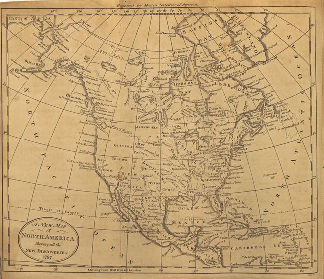
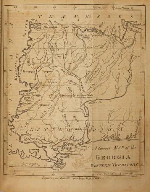
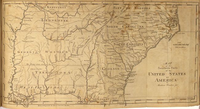
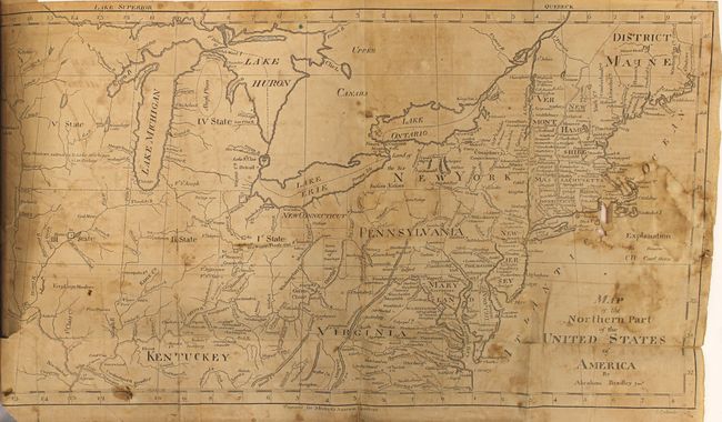
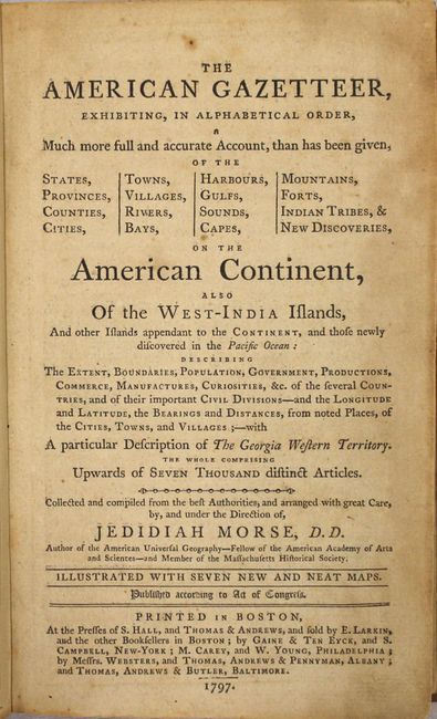
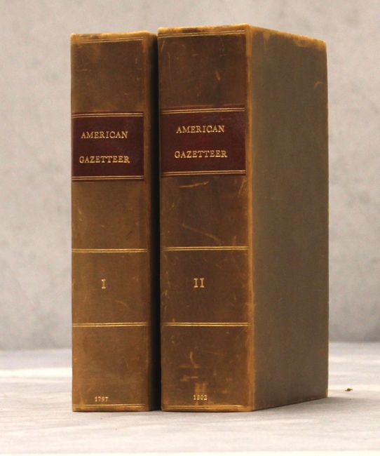
This is a complete two-volume set of the first edition of this early American geography book that is considered to be the country's first gazetteer. Volume I contains seven folding maps, including the Georgia Western Territory map which is not present in all copies. An example of the young country's anxious desire to expand westward can be seen on the Map of the Northern Part of the United States, which shows several numbered designations for future states in the upper Midwest. This particular map also shows northern Ohio as New Connecticut. The populations of the states, cities and towns are reported according to the fledgling nation's first official census in 1790. The list of maps in Volume I:
A. A New Map of North America Shewing all the New Discoveries. Condition: Backed in Japanese tissue to repair several fold separations. Light toning and minor offsetting. (B+)
B. A Map of South America and the Adjacent Islands.
C. A Correct Map of the Georgia Western Territory.
D. Map of the Northern Part of the United States of America by Abraham Bradley Junr. Condition: There is a large damp stain at far right that has caused several tears and one small hole in the Atlantic. There are a number of old paper repairs to fold separations on verso, however some of the separations have reformed. (C+)
E. Map of the Southern parts of the United States of America by Abraham Bradley Junr. Condition: Several small stains primarily at top right. (B)
F. Chart of the New Discoveries East of New Holland and New Guinea.
G. West Indies from the Best Authorities. Condition: Several small stains. (B)
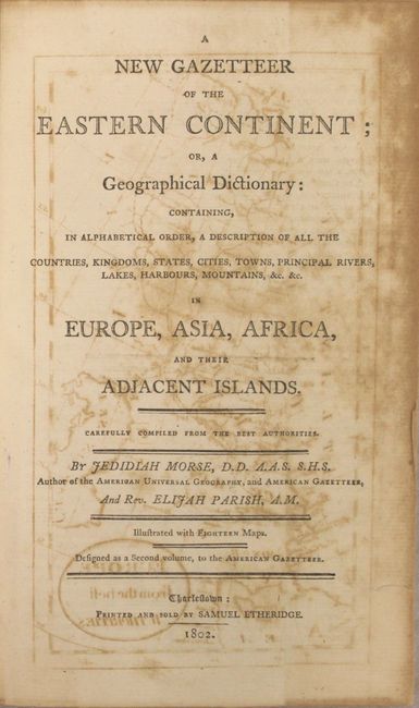
Volume II contains 17 maps, including: the continents of Europe, Asia, and Africa; 10 maps of European countries; Holy Land; Turkey & Hungary; India; and Egypt. 8vo. Complete. Published in Boston by S. Hall and Thomas & Andrew. Rebound in full leather with red title labels and decorative gilt on the spine.
References: Howes #M839; Wheat & Brun #158, 244, 496, 618, 699, 714, 911.
Condition: B
The majority of the maps have moderate offsetting, toning, and soiling. See description for additional details on individual maps. The text is toned with light scattered foxing. The new bindings are in very nice condition with light sunning and wear to the spines.