Subject: Southern Africa
Period: 1727 (circa)
Publication: Naaukeurige Beschryving van De Kaap de Goede Hoop
Color: Hand Color
Size:
21.6 x 17 inches
54.9 x 43.2 cm
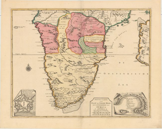
This is a very rare map of South Africa, published by Balthazar Lakeman in Peter Kolbe's Naaukeurige Beschryving van De Kaap de Goede Hoop. The map extends north to the city of Mozambique and east to include part of Madagascar. Two insets depict the Dutch fort at the Cape of Good Hope and Table Bay. Kolbe (1675–1726) was commissioned by Nicolaas Witsen, mayor of Amsterdam, to travel to South Africa to gather information about the region and conduct astronomical and surveying research. He worked at the Cape from 1705-13, and compiled a comprehensive description of South Africa, including information on the flora, fauna, native Hottentots, geography, climate, and the Dutch government of the Cape. Kolbe published his work upon his return to Europe, with the first edition published in both Latin and German under the title Caput Bonae Spei Hodiernum in 1719. A Dutch two-volume edition was published in 1727.
References: cf. Norwich #163.
Condition: A
Full original with a few tiny spots and minor marginal soiling.