Subject: Northern Asia
Period: 1814 (dated)
Publication: New General Atlas
Color: Hand Color
Size:
23.3 x 19.3 inches
59.2 x 49 cm
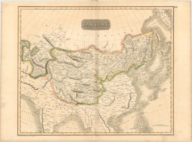
This detailed map of Chinese Tartary extends to the Caspian Sea in the west and covers most of India in the south, with numerous towns, rivers, lakes and mountain ranges depicted. A portion of the silk road is shown from Pahacachon to Pong, and interesting geographical and political notations are included, such as "the river is lost here in the sands" and "the supposed situation of Kara Kum the capital of Zinghis Khan's Empire." Turkmenistan, Uzbekistan, Kyrgyzstan and Tajikstan are called Independent Tartary, and are occupied by various khanates such as the Great Horde and the Kirguses. Engraved by N. R. Hewitt.
References:
Condition: B+
Original outline color on paper watermarked "J. Whatman 1813" with light toning along the centerfold and marginal soiling.