Subject: Holy Land
Period: 1650 (published)
Publication: A Pisgah-Sight of Palestine
Color: Hand Color
Size:
13.4 x 11.3 inches
34 x 28.7 cm
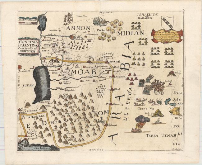
This delightfully illustrated map is from what R.V. Tooley described as "the most quaint and decorative series of maps." The map covers eastern Palestine, east of the Jordan, including the Tribes of Gad and Reuben. The map is filled with biblical illustrations and is adorned with a coat of arms and dedication to Henrico Barnard. Engraved by Thomas Cross.
Thomas Fuller (1608-1661) was a respected English clergyman who wrote several books on the history and geography of the Holy Land. His A Pisgah-Sight of Palestine, published in 1650, was a geographical description of the Holy Land with special reference to biblical history. Fuller financed the book by dividing it into sections and finding sponsors for each one. To acknowledge the patrons, all maps contained decorative cartouches with the sponsor's coat of arms and a dedication to him.
References: Laor #294; Nebenzahl (HL) p.128-131, #19; Shirley (BL Atlases) G.FULL-1a #18.
Condition: A
A dark impression on watermarked paper with several worm tracks mostly confined to the blank margins that have been professionally infilled, including two that enter the image at top center, with a minor amount of image replaced in facsimile. A number of small scratches in the plate are visible.