Catalog Archive
Auction 159, Lot 541

"Carte Routiere de l'Italie Indiquant les Divisions Politiques des Divers Etats. Dressee en 1820", Brue, Adrien Hubert

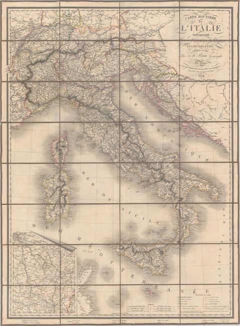
Subject: Italy, Switzerland, Croatia, Slovenia, France

Period: 1824 (dated)

Publication:

Color: Hand Color

Size:
23.8 x 32.1 inches
60.5 x 81.5 cm
Download High Resolution Image
(or just click on image to launch the Zoom viewer)

This large, handsome map of Italy includes an inset stretching from Paris to Chambery in France. The map extends to Sicily, Sardinia, Corsica, Switzerland, Slovenia, and Croatia. Cities, towns, villages, roads, canals, and postal roads (with distances) are located, and there is nice topographical detail. Published by Charles Simmoneau. The map is dissected into 32 sections and mounted on original linen and housed in a marbled cardboard slipcase.

References:

Condition: B+

Light offsetting and minor soiling. The slipcase has light wear with a small chip above the title label.

Estimate: $275 - $350

Sold for: $240

Closed on 9/14/2016

Archived