Subject: Belgium, Northern France
Period: 1925 (dated)
Publication: Statistical Review of Relief Operations
Color: Printed Color
Size:
13.5 x 15.4 inches
34.3 x 39.1 cm
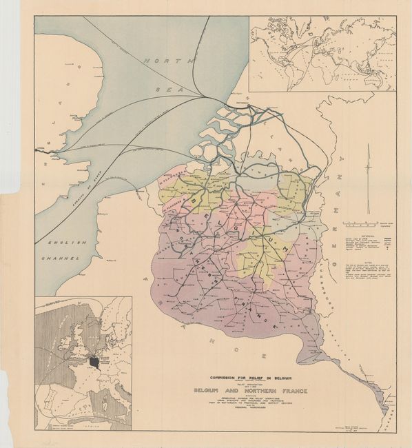
This map was produced for the Commission for Relief in Belgium and depicts all of Belgium and a small portion of northern France during World War I. Headed by future president Herbert Hoover, the organization provided vital food supplies to Belgian citizens who were under German occupation. Given Belgium's small size and population density, it could provide only 20-25% of its necessary food supply, and the German occupation diverted most of those resources to its army. Thus, having a well organized relief effort was critically important to the lives of nearly 10 million Belgian citizens. Cartographically, the map emphasizes the transportation network used to deliver the food supply and depics canals, main railways, and secondary railways. It is augmented by two small inset maps showing the incoming supplies from North America, South America, Australia and India. Published in the Statistical Review of Relief Operations by George Gay.
References:
Condition: A+
Issued folding on a clean sheet.