Subject: Amsterdam, Netherlands
Period: 1658 (circa)
Publication:
Color: Black & White
Size:
21.3 x 16.3 inches
54.1 x 41.4 cm
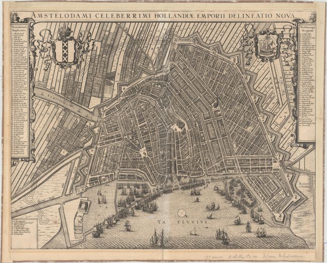
This attractive bird's-eye plan of Amsterdam shows the city during it's Golden Age as one of the leading trading empires of Europe. The plan shows the city center enclosed within the medieval town walls. The new expanded city limits and canal systems are depicted with fortifications built-out on the right and drawn in dotted lines to show the area to be enclosed on completion of the construction. Thousands of tiny buildings are shown divided by the Amstel river, with the stock exchange and fish market at center, and many windmills dotting the outer city wall. At left and right there is an impressive key with 110 numbered locations. In the foreground, numerous sailing ships and docks fill the busy port. The city's coat of arms is at left and arms of the VOC is on right. Jansson's map is nearly identical to Bleau's version published in Groot Toonneel der Steden (Town Atlas of the Low Countries) but excludes the dedication and imprint at bottom left. Latin text on verso.
References:
Condition: B
There are faint spots in the image along the centerfold and light toning along the border in the blank margins. Remargined at left, right, and top to better accommodate framing. The verso has paper tape along sheet edges.