Subject: Poland, Baltic States, Ukraine
Period: 1744-62 (circa)
Publication:
Color: Hand Color
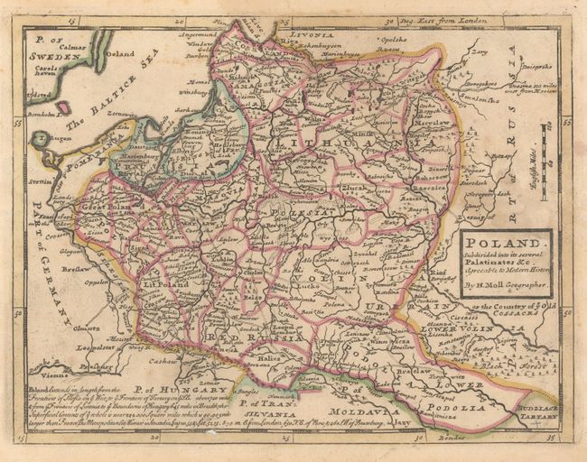
A. Poland. Subdivided Into Its Several Palatinates &c. Agreeable to Modern History, by Herman Moll, from Modern History, circa 1744 (10.4 x 7.9"). This copper engraved map of Poland and the Baltic states extends as far north as Riga, Latvia. It includes excellent detail of roads, major cities, and towns. This is the second state, with a long note at the bottom that provides the lengths of Poland's frontiers and the location of Warsaw in relation to London, Paris, and St. Petersburg. Published in London in Thomas Salmon's Modern History: or the Present State of All Nations. Ref: McCorkle (18th C. Geography) #349 Vol. II-11 (State B). Condition: On watermarked paper with light damp stains at right, and a small hole in the border at bottom. (B+)
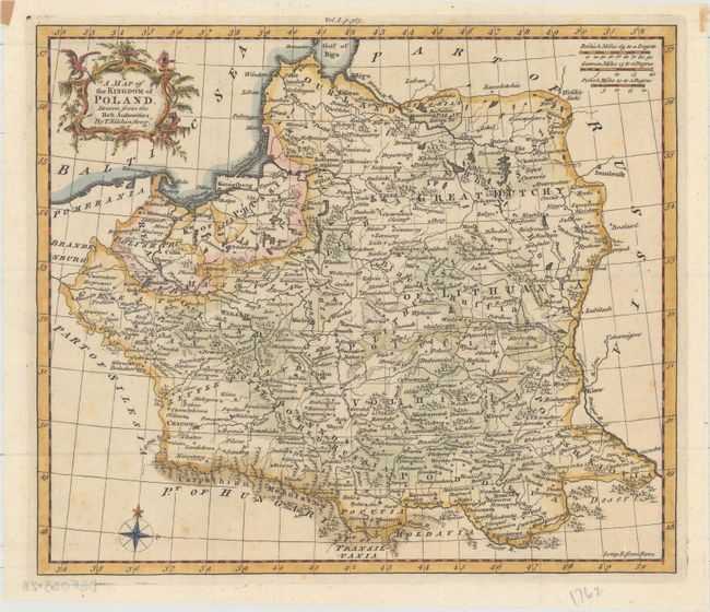
B. A Map of the Kingdom of Poland. Drawn from the Best Authorities, by Thomas Kitchin, from A New System of Geography..., published 1762 (10.2 x 8.8"). This elegantly engraved map centers on Poland and extends to show Belarus, Lithuania, and parts of Latvia and the Ukraine. It locates political divisions and towns and cities, including Warsaw, Krakow, Vilnius, Minsk, Riga, and Kiev, and features some nice topographical detail. There is a decorative title cartouche at top left, a compass rose at bottom left, and three distance scales at top right. Ref: McCorkle (18th C. Geography) #36 Vol. I-8. Condition: A nice impression with a few spots of foxing that is confined to unengraved areas and remnants of hinge tape in the top blank margin. (A)
References:
Condition:
See description above.