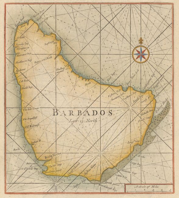
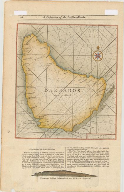
Subject: Barbados
Period: 1789 (circa)
Publication: The English Pilot - The Fourth Book
Color: Hand Color
Size:
10.2 x 11.4 inches
25.9 x 29 cm
This map of Barbados was originally created by John Thornton and William Fisher with the title The Iland of Barbados and published in 1689. The map appeared in a number of different editions of The English Pilot, the Fourth Book, with later editions omitting the title and setting the engraving within the text. The land approach view of the island below the map changed significantly over the years and can be used to identify the edition in which the map was published. On a full sheet of English text measuring 12.0 x 18.9".
References: Campbell (MCC-21) #12; Shirley (BL Atlases) M.M&P-5a.
Condition: A
A nice example with light toning along the edges of the sheet and a few small chips along the bottom edge of the sheet. There are creases above and below the map where the map was folded to accommodate framing. Remnants of hinge tape on verso.