Catalog Archive
Auction 159, Lot 35

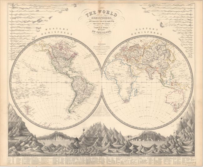
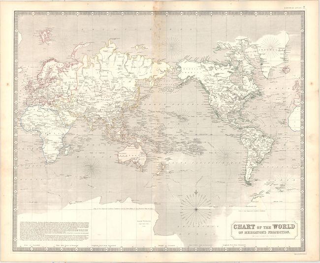
"[Lot of 2] The World in Hemispheres, with Comparative Views of the Heights of ths Principal Mountains and Lengths of the Principal Rivers on the Globe [and] Chart of the World on Mercator's Projection", Johnston, Alexander K.

Subject: World

Period: 1845 (circa)

Publication: National Atlas

Color: Hand Color

Size:
24 x 20.6 inches
61 x 52.3 cm
Download High Resolution Image
(or just click on image to launch the Zoom viewer)

This attractive lot depicts the world on two projections. The first is a double-hemisphere map that is surrounded by elaborate comparative views of principal mountains and rivers. In North America, Canada extends south to the Columbia River, reflecting British claims in the region. The second map is centered on the Pacific Ocean, and shows the tracts of Captain Cook's voyages in the southern hemisphere. A rudimentary outline of Antarctica is shown, with the interior labeled "part of the supposed southern continent." From Johnston’s early lithographed edition of his National Atlas.

References:

Condition: B+

Scattered foxing along the upper centerfold and minor toning and soiling primarily in the blank margins.

Estimate: $275 - $350

Sold for: $190

Closed on 9/14/2016

Archived