Subject: Caribbean
Period: 1721 (published)
Publication: A New General Atlas…
Color: Hand Color
Size:
24.2 x 20.1 inches
61.5 x 51.1 cm
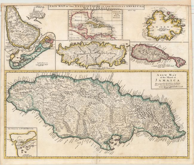
An uncommon large map with eight maps on a single sheet. The major map is of Jamaica with its parishes and very fine detail and notations throughout and an inset map of Port Royal harbor. Arrayed at top are maps of Barbados (with an inset of Bridgetown), the entire West Indies, Antigua, St. Kitts, Tobago and Bermuda. This is a revised version of Christopher Browne's map of 1690 with Senex's imprint in title. Engraved by J. Harris.
References: Shirley (BL Atlases) T.SEN-2a, #32; Palmer (MCC-19) #26; Kapp (MCC-42) #41.
Condition: B+
A crisp impression with original outline color on watermarked paper. There is very light soiling and professional repairs to several separations along the centerfold and to several short edge tears, one of which enters 1" into map at top right. Remargined at top to accommodate framing.