Subject: Gulf of Mexico & Caribbean
Period: 1639 (circa)
Publication: Nouveau Theatre du Monde
Color: Hand Color
Size:
20.6 x 14.9 inches
52.3 x 37.8 cm
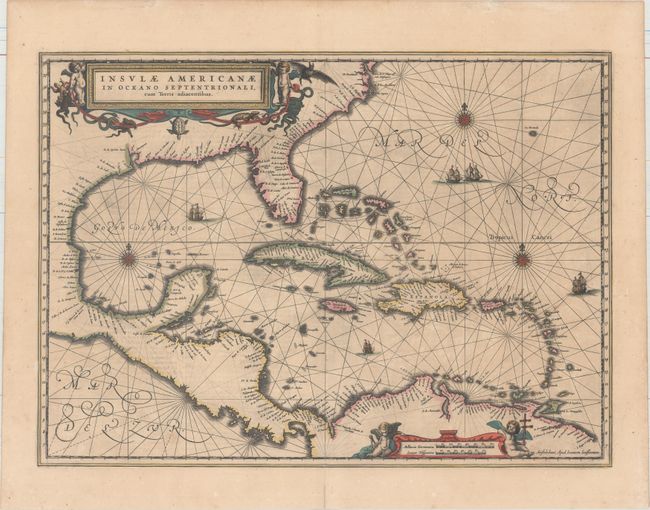
This handsome map focuses on the West Indies and covers the region from the Chesapeake through the Gulf of Mexico, with Central America and the northern part of South America. Details are confined to the coastlines. Cartographically it is based on the extremely rare chart of Hessel Gerritsz from 1631 and is nearly identical to Blaeu's map of the same title. This is the first state of this map, French text on verso, published between 1639-49. Lovely title and scale of miles cartouches, rhumb lines, compass roses, and sailing ships make this a very attractive map.
References: Burden #248; Van der Krogt (Vol. I) #9600.1.
Condition: B+
A dark impression with full original color, light printer's ink residue, a professionally repaired centerfold separation that enters less than 1" into map at bottom, and a small hole along the western coast of the Gulf of Mexico.