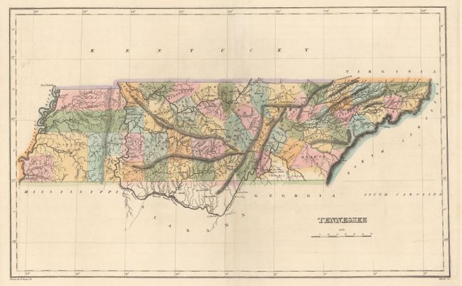
Subject: Tennessee
Period: 1822 (circa)
Publication: A Complete Historical, Chronological, and Geographical American Atlas...
Color: Hand Color
Size:
18.2 x 11.3 inches
46.2 x 28.7 cm
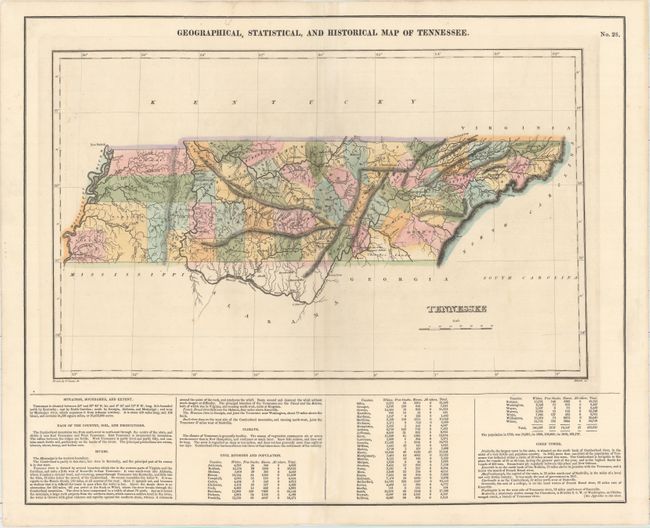
The map is on a full folio sheet (20.5 x 16.7") with English text below giving a brief description of Tennessee's boundaries, productions, rivers, climate, chief towns, and population statistics by county. The finely engraved map delineates rivers, roads, counties, and major towns. The western portion of the state is dominated by the large Henry, Carroll, Henderson, Madison, and Shelby counties, which would be subdivided over the next few years. Cherokee Lands is located in the southeastern portion of the state. Kentucky and Tennessee are almost always shown on the same map, so it is uncommon to find Tennessee alone during this period. Drawn by Fielding Lucas, Jr. and engraved by Kneass.
References: Phillips (Maps) p. 838.
Condition: B
There are several short tears and separations along and around the centerfold that have been repaired with archival materials, with a small amount of loss in image in Smith and Warren counties.