Subject: Missouri
Period: 1834 (published)
Publication:
Color: Hand Color
Size:
11.3 x 9.6 inches
28.7 x 24.4 cm
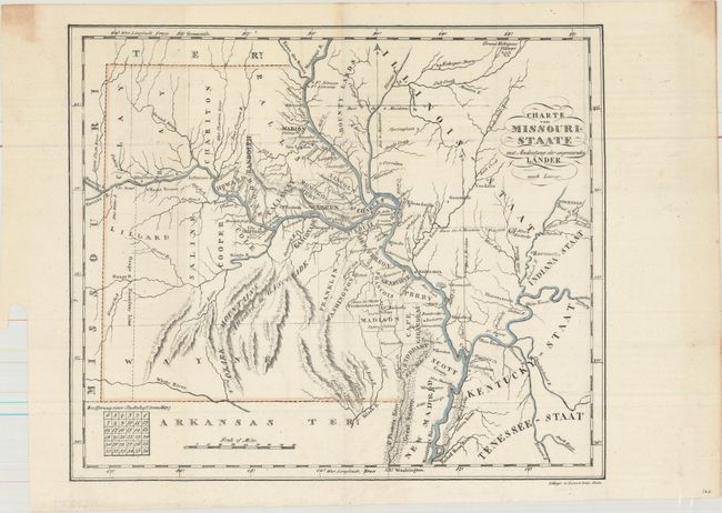
This early German lithograph of the state is based upon an earlier map by Fielding Lucas. It was published in Gottfried Duden's Bericht uber eine Reise nach den Westlichen Staten Nordamerika's und einen mehrjahrigen Aufenthalt am Missouri... (Report on a trip to the Western States of North America and a multi-year stay at Missouri). Duden's description of life on the frontier was credited with bringing thousands of German settlers to the region. Cartographically, the map is current to 1829 with the addition of Randolph and Marion counties in the north. Development is primarily along the rivers with the Osage Boundary Line depicted in the west. Bounty Lands are shown in Illinois along the Mississippi River. Missouri Territory and Arkansas Territory surround the state to the west and south. Lithographed by Dunst & Company in Bonn, Germany.
References: Sabin #21073; Graff #1165.
Condition: A
A mostly clean and bright example, issued folding. There are two small stains in the top corners of the sheet away from the map image.