Subject: Boston, Massachusetts
Period: 1855-1915 (circa)
Publication:
Color:
This lot consists of one pocket map and two atlas maps of Boston covering a time period spanning approximately 60 years.
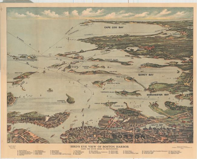
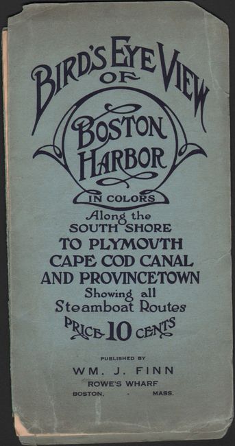
A. Bird's Eye View of Boston Harbor Along the South Shore to Provincetown, by William J. Finn, dated 1915, printed color (19.3 x 14.1"). Nice bird's-eye map produced for the tourist trade. The attractively colored map folds into paper covers with the title "Bird's Eye View of Boston Harbor in Colors Along the South Shore to Plymouth, Cape Cod Canal, and Provinceton." Below the map is a numerical key to 25 landmarks and lighthouses. The map names East Boston, Dorchester Bay, Quincy Bay, Governor's Island, Peddock's Island, Deer Island, Nantasket Beach, Duxbury, Jerusalem and much more. Numerous ferry and ship routes are shown. Condition: Issued folding with light toning and two short fold separations confined to the blank margins that are closed on verso with archival tape. Front paper wrapper has separated from the map. (B+)
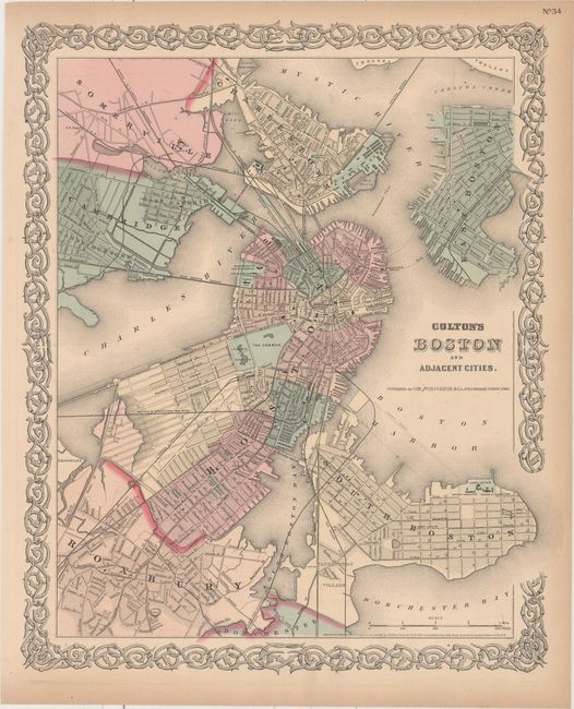
B. Colton's Boston and Adjacent Cities, by G.W. & C.B. Colton & Co., dated 1855, hand color (13.3 x 15.9"). Very handsome and detailed plan of the city after the filling in the Back Bay. Extends to include South Boston, Roxbury, Cambridge, Somerville, Charlestown, and East Boston. Names at least nine railroads and eight bridges. Decorative scroll borders. Condition: Light toning confined to sheet edges. (A)
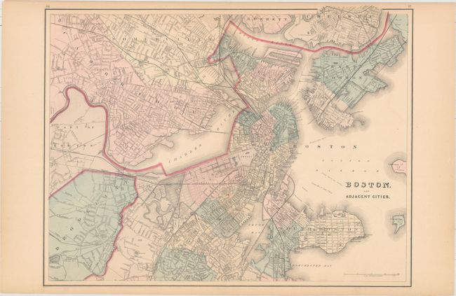
C. Boston and Adjacent Cities, by O.W. Gray, circa 1876, hand color (21.8 x 16.8"). This is the double-page, second edition chart that shows Boston and much of the surrounding area. Includes Brookline, Cambridge, Somerville, East Boston, South Boston and parts of Everett and Chelsea. Good detail of the current development including reclamation and railroad detail and locations of parks and common areas, important buildings, and major streets and roads. Condition: Light toning confined to sheet edges. (A)
References:
Condition:
See description above.