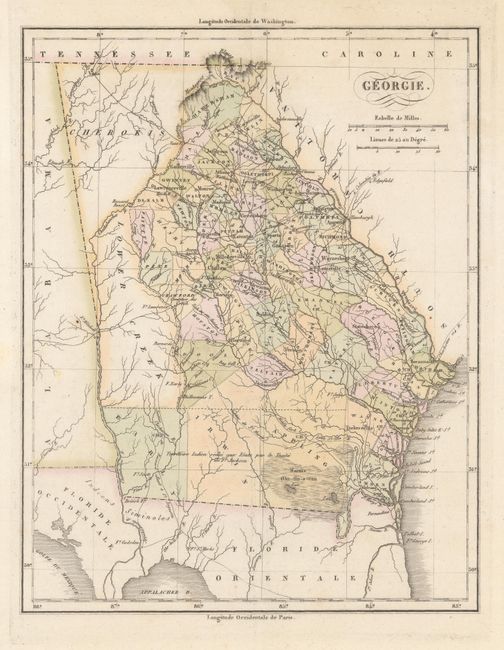
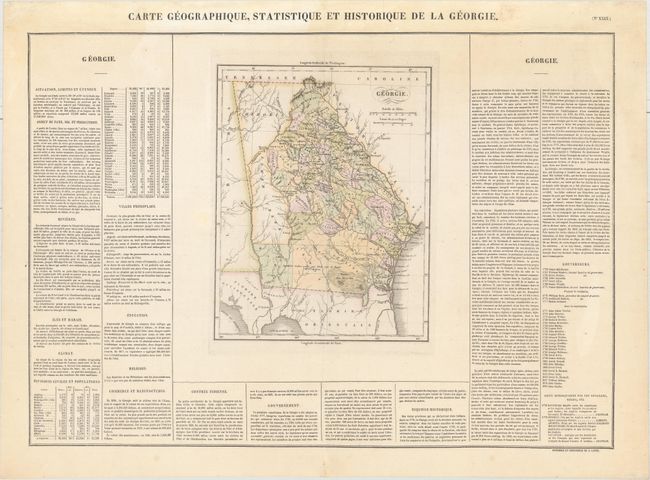
Subject: Georgia
Period: 1825 (circa)
Publication: Atlas Geographique, Statistique, Historique et Chronologique…
Color: Hand Color
Size:
8.8 x 11.3 inches
22.4 x 28.7 cm
This map is from the French edition of Carey & Lea's American Atlas with French text surrounding the map on three sides of the large folio sheet. The county lines reflect the boundaries as of 1822. The map also depicts roads, towns, and large regions to the south and west of the state still belonging to various Indian tribes, including the Creek and Cherokee tribes. Early, Irwin, and Appling counties are marked with the notation, "Territoire Indien aux Etats par le Traite du Ft. Jackson" (Indian territory to the States by the Treaty of Fort Jackson). John Clarke was the governor at the time of publication, serving his second term. The full sheet with text measures 26.5 x 19.6".
References:
Condition: B+
A nice impression with a bit of light uneven toning at top.