Subject: Minnesota & Dakotas
Period: 1851 (circa)
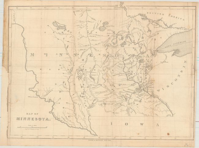
Publication: Minnesota Year Book for 1851...
Color: Black & White
Size:
16.4 x 12.2 inches
41.7 x 31 cm
This map of Minnesota Territory was published in William Le Duc's Minnesota Year Book for 1851.... Issued shortly after the formation of the territory, the map covers the region from Lake Superior to the Missouri River. Only a few towns and settlements are named near the Mississippi River including St. Paul, Stillwater, Ft. Snelling, and St. Croix and the rest of the territory is filled with Indian tribe names. Rivers and lakes are well developed in the region with Fort Pierre Chouteau located on the Missouri River. Engraved by William Kemble and published by Harper & Brothers in New York.
References: Graff #2435; Sabin #39689.
Condition: B
Issued folding and now flattened and backed with tissue to reinforce and repair a few tiny fold separations. Remargined at right and left with a minor portion of the left border trimmed away. Minor soiling with two small repaired edge tears at right.