Subject: Mid-Atlantic United States
Period: 1855-74 (dated)
Publication:
Color: Hand Color
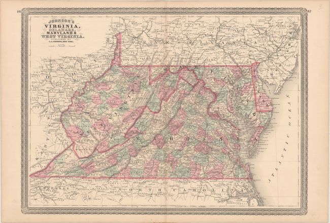
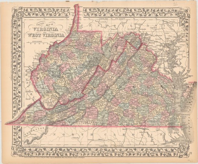
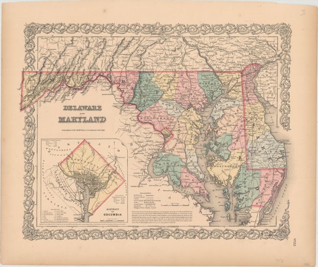
These maps with decorative borders are absolutely filled with details, including county development, towns, roads, railroad routes, trails, forts, and more.
A. Johnson's Virginia, Delaware, Maryland & West Virginia, by A.J. Johnson, dated 1864 (23.1 x 16.8").
B. County Map of Virginia and West Virginia, by Samuel Augustus Mitchell, dated 1874 (14.9 x 11.9").
C. Delaware and Maryland, by Joseph Hutchins Colton, dated 1855 (16.3 x 12.9"). Includes an inset of Washington, DC, with 12 key locations identified.
References:
Condition: A
Clean and bright examples with light toning along the edges of the sheets. The Johnson map has faint toning along the centerfold, the Mitchell map has binding holes in the top blank margin, and the Colton map has a couple of minor creases confined to the blank margins.