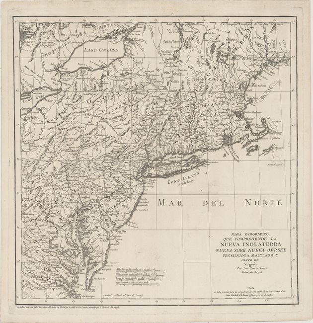
Subject: Colonial New England - United States
Period: 1778 (dated)
Publication:
Color: Black & White
Size:
15.1 x 15.4 inches
38.4 x 39.1 cm
This is one of the rare Spanish maps of the United States outside of those regions formerly colonized by the Spanish. It was issued during the American Revolution and shows the region from southern Maine to the Chesapeake and west to include part of Lake Erie. New York is identified along the Hudson River with a huge area of upstate New York labeled Iroqueses. Numerous forts are located to the south of Lake Champlain including Fort Miller, Edward, Hardy and Hunter. Maine is identified in a smaller font as Mayn. The map is acknowledged to be based on those of Evans, Mitchell, Jeffreys, and d'Anville. Longitude is from El Hierro, the smallest and southernmost of the Canary Islands.
References: McCorkle #778.7; Shirley (BL Atlases) T.LOP-3a #2, Vol 2.
Condition: A
A dark impression on a sheet of watermarked paper with minor soiling.