Subject: Colonial New England & New York
Period: 1780 (published)
Publication: Universal Magazine
Color: Black & White
Size:
10.6 x 13.1 inches
26.9 x 33.3 cm
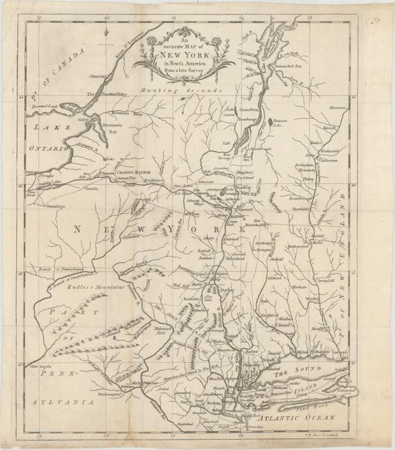
Despite the title, this map centers on New York but also covers parts of Pennsylvania, New Jersey, Connecticut Massachusetts and Vermont. It provides an excellent view of colonial settlements, forts and roads. Three different boundary line claims are shown between New Jersey and New York. West of the Delaware River are Endless Mountains and northern New York is labeled Hunting Grounds.
References: Jolly #UNIV-187; Sellers & Van Ee #1112.
Condition: B+
Issued folding, now flattened, on watermarked paper with an archivally repaired fold separation at bottom, minor toning along one fold, faint soiling, and some tiny wormholes that are only visible when held up to light. A small chip at bottom has been replaced with old paper with a minor amount of neatline done in facsimile.