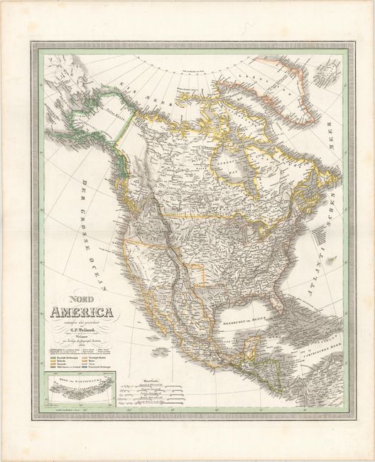
Subject: North America
Period: 1841 (dated)
Publication:
Color: Hand Color
Size:
19.7 x 22.9 inches
50 x 58.2 cm
This detailed German map of the continent names plenty of towns and cities and features good topographical detail. The Republic of Texas appears in a diamond-like shape without the panhandle or Far West Texas. There is a large Jowa Terr. to the west of Wisconsin, and, farther west, there is an area labeled Missouri that is separate from state. Oregon Territory is delineated in the Pacific Northwest with its border extending well into present-day Canada, reflecting the United States claims to the territory. Numerous Indian tribes are located, especially in the western United States. A small inset at bottom left focuses on the Aleutian Islands. The map is color-coded to indicate the holdings of various powers on the continent. Surrounded by a keyboard-style border.
References:
Condition: A
Faint offsetting and occasional faint stains that are primarily in the blank margins.