Subject: Colonial Mid-Atlantic United States
Period: 1632 (published)
Publication: Gerardi Mercatoris Atlas sive Cosmographicae…
Color: Black & White
Size:
10.1 x 7.3 inches
25.7 x 18.5 cm
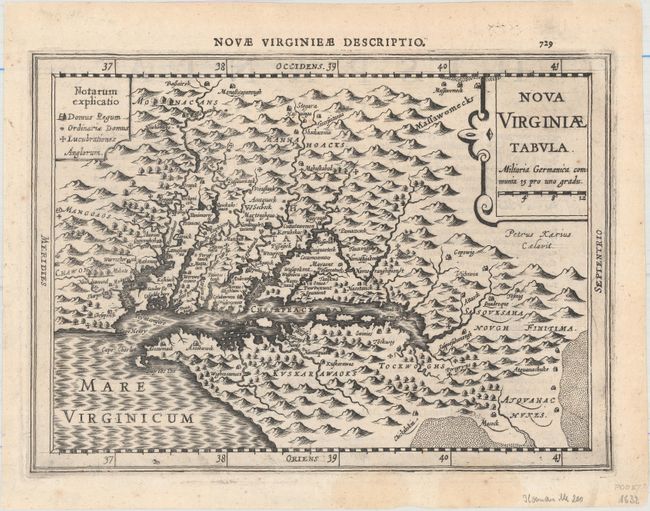
This delicately engraved map is a reduced version of John Smith's map of the Chesapeake Bay region (fourth derivative). Despite its small size, it is filled with towns with both English and Native names, including Jamestown (Iamestowne), and a key to the types of buildings on the left and pictorial topography. Engraved by Pieter van den Keere with his Latinized name appearing below the title cartouche. In this Cloppenburg edition, Keere increased the map size from 5 x 7" to 7 x 10" inches. Published in 1632 with page 729 at top right and Latin text on verso describing the following map (Hispania Nova).
References: Burden #226; Tooley (America) plt. 72.
Condition: A
A dark impression with two small damp stains at the bottom of the sheet that just enter the border.