Catalog Archive
Auction 158, Lot 290

"The Kingdom of France Describing the New Limits According to the Treaty of Paris, November 20th. 1815", Wyld, James
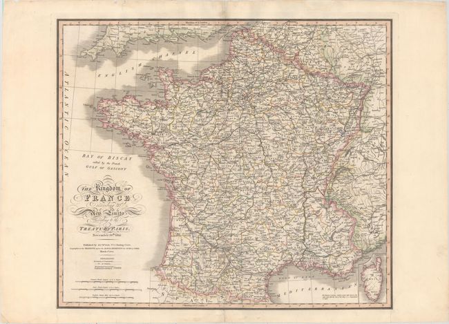
Subject: France

Period: 1825 (dated)

Publication:

Color: Hand Color

Size:
24 x 20.7 inches
61 x 52.6 cm
Download High Resolution Image
(or just click on image to launch the Zoom viewer)

This detailed, large-scale map of France depicts the departments, districts, key cities, and major roads. The island of Corsica is shown in a small inset at bottom right. The borders are shown according to the 1815 Treaty of Paris, which ended the Napoleonic Wars and reverted France's boundaries to their 1790 level.

References:

Condition: B+

Original color on paper with "J. Whatman 1825" watermark and minor soiling and offsetting. There are professional repairs to separations along the centerfold and several marginal tears and chips.

Estimate: $180 - $210

Unsold

Closed on 6/22/2016

Archived