Subject: Western Hemisphere - America
Period: 1777 (dated)
Publication: The General Atlas
Color: Hand Color
Size:
47 x 20.4 inches
119.4 x 51.8 cm
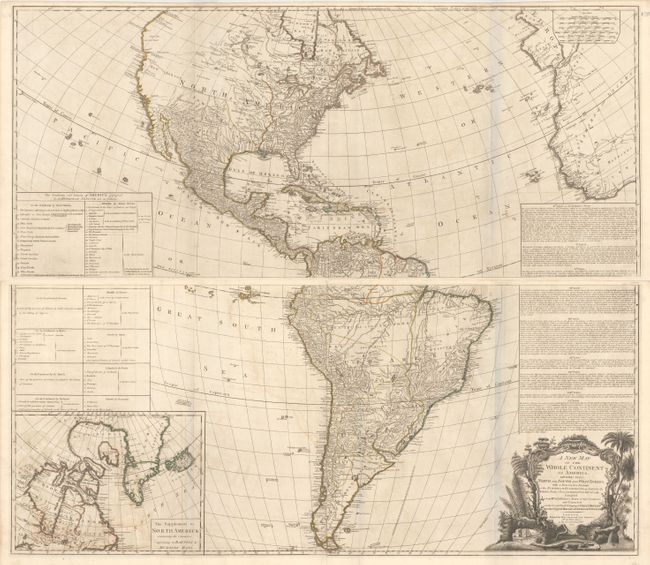
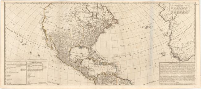
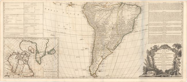
This impressive, large-scale map of North and South America was originally drawn by John Gibson in 1763 with a slightly different title. The map went through several revisions; this is the third state. The huge map is filled with incredible detail and is based on D'Anville's cartography, as well as Spanish explorations on the west coast of North America and the journals of Governor Pownall in New England and Canada. The British colonies are shown with the western boundary on the Mississippi and Ohio Rivers. This issue includes Fort Detroit located at the southern end of the Lake St. Clair, which has been considerably altered in shape from previous editions. In the west are two possible locations for a River of the West; one with its source at Pike's Lake, the other further north at Lake Winnipeg. A Chinese colony, Fou Sang is shown in present-day British Columbia, just north of a notation concerning the Sea of the West. At lower left is an inset map of Hudson and Baffin's Bay. Above the inset is a large text panel listing of the Articles of the Treaty of Paris of 1763. The baroque-style title cartouche features a beaver, a crocodile and an Indian headdress amid trees, a waterfall and tropical flora. Although the map is dated 1777, this example was published in the 1780 edition of The General Atlas. Printed on four sheets (joined to form two pairs) as issued. The map would measure 46.5 x 41" if joined.
References: Stevens & Tree (MCC-39) #3c.
Condition: B+
Original outline color on watermarked paper with light offsetting. There are bluish lines along several folds that are caused by our scanner and do not appear on the map itself.