Subject: Western Hemisphere - America
Period: 1746 (dated)
Publication:
Color: Hand Color
Size:
25.1 x 19.4 inches
63.8 x 49.3 cm
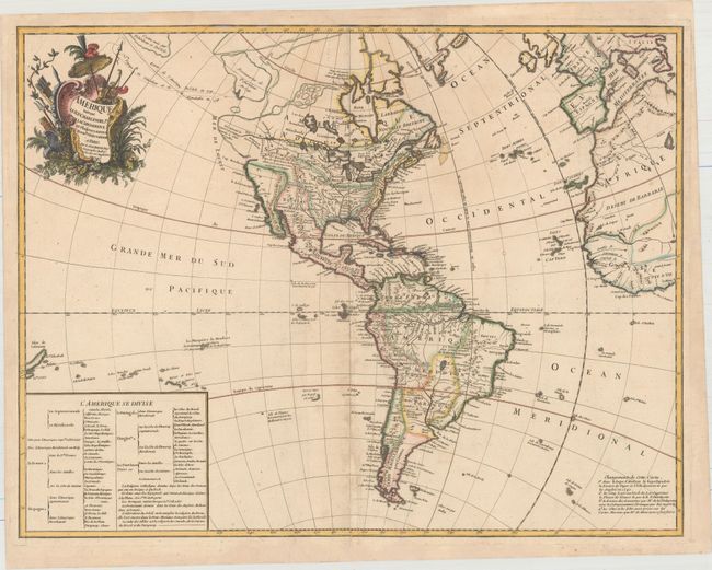
This fascinating map illustrates some of the most interesting mythical cartography juxtaposed with important new discoveries in North America. The routes of Delisle and Tchirikow are shown in 1741 terminating on a vague island in the approximate location of Alaska. A Northwest Passage (shown by lightly engraved lines) links the Pacific with Hudson Bay where there is a note concerning the British discoveries of 1742. The Riv. de l' Ouest stretches from Lake Superior nearly to the Pacific, based on the reports of the Jesuit missionary, Pierre de Charlevoix. In South America the Amazon River is detailed according to Condamine's expedition. A text table lists the colonial possessions. This is the second state, published circa 1753. Text at bottom right explains the changes made to the plate.
References: Map Collector #64, p. 18-23; McGuirk #15.
Condition: B+
A nice impression on watermarked paper with attractive color and light soiling. A centerfold separation at bottom has been professionally repaired, and an adjacent printer's crease has been pressed flat and reinforced on verso. There are additional professional repairs to some minor chips and tears along the edges of the sheet, not affecting image.