Subject: Western Hemisphere - America
Period: 1666 (dated)
Publication: Cosmography
Color: Hand Color
Size:
16.3 x 13.3 inches
41.4 x 33.8 cm
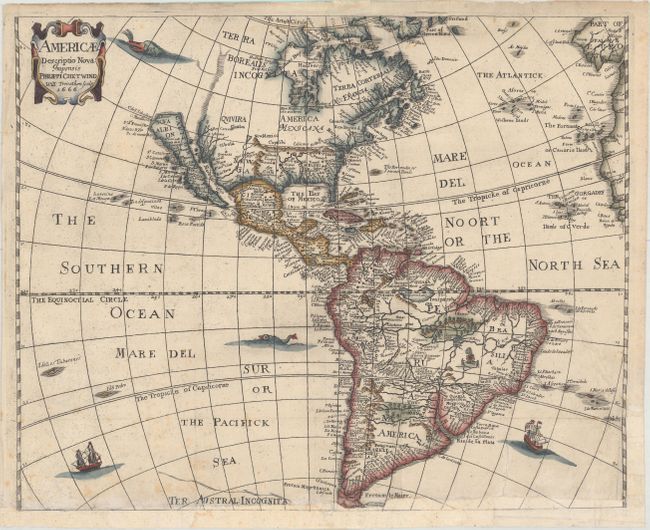
Boldly engraved map of the Americas based on the work of Abraham Goos for John Speed. It depicts California as an island with many names and islands surrounding it, no Great Lakes and a faint allusion to the northwest coast of North America. On the east coast, Norumbega, Maryland, No: Belgium, and Long Ile are named. South America has the fictitious Parim and Eupana lakes, as well as dramatic river systems and many place names. The map is decorated with a title cartouche, sea monsters, and sailing ships. This is the third state, issued by Philip Chetwind for Peter Heylin with his imprint replacing Seile's.
References: Burden #308; McLaughlin #13-3 & 39; Tooley (Amer) p.115, #13.
Condition: B
A dark, crisp impression on watermarked paper, issued folding, and now pressed with folds reinforced on verso with tissue. Two tears, extending 2.5" and 3.5" into map at bottom right, have been professionally repaired. A long chip at bottom, extending less than 0.5" into image at bottom right, has been replaced with old paper, with neatline and a portion of rhumb lines replaced in facsimile.