Catalog Archive
Auction 157, Lot 726

"[Lot of 2] New Zealand North Island New Ulster or Eaheinomauwe [and] New Zealand Middle & South Islands", Dower, John

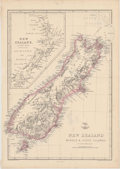
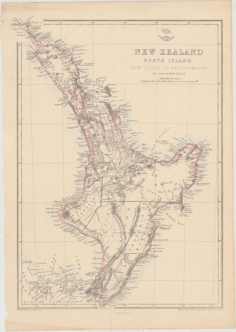
Subject: New Zealand

Period: 1860 (circa)

Publication: Weekly Dispatch Atlas

Color: Hand Color

Size:
12.8 x 17 inches
32.5 x 43.2 cm
Download High Resolution Image
(or just click on image to launch the Zoom viewer)

These two maps provide a detailed look at the islands of New Zealand. The first sheet shows North Island (also referred to as New Ulster or Eaheinomauwe), while the second focuses on South Island (here called Middle Island) and Stewart Island (also labeled as South Island or Rakiura) south of Cook Strait. Both maps are teeming with details, including provinces, towns and cities, rivers, lakes, mountains, bays, smaller islands, and notes on the terrain. An inset on the second sheet zooms out to show New Zealand in full. Size varies slightly. Published in the Weekly Dispatch Atlas by Edward Weller.

References:

Condition: A

Original color with a minor vertical crease on each sheet and marginal soiling.

Estimate: $160 - $190

Sold for: $100

Closed on 5/4/2016

Archived