Subject: Society Islands
Period: 1780-85 (circa)
Publication:
Color: Black & White
Captain James Cook (1728-1779) is best known for his three voyages to the Pacific (1768-71; 1772-75; and 1776-79). His discoveries radically changed the western understanding of the world in the late 18th century. He was the first to circumnavigate and chart New Zealand and provided the earliest European accounts of exploration along the eastern coast of Australia and the Hawaiian Islands. On February 14th, 1779, he was killed on Hawaii after attempting to kidnap the chief of the island.
Many contemporary accounts of Cook’s voyages, including charts and engravings, appeared in the late 18th century. The first official account of Cook’s first voyage was published in 1773 by John Hawkesworth in Volumes II and III of An Account of the Voyages Undertaken by the Order of His Present Majesty for Making Discoveries in the Southern Hemisphere... William Strahan and Thomas Cadell published the first official accounts of the second and third voyages in 1777 and 1784. Accounts of his exploration were subsequently translated into French, German, and Dutch.
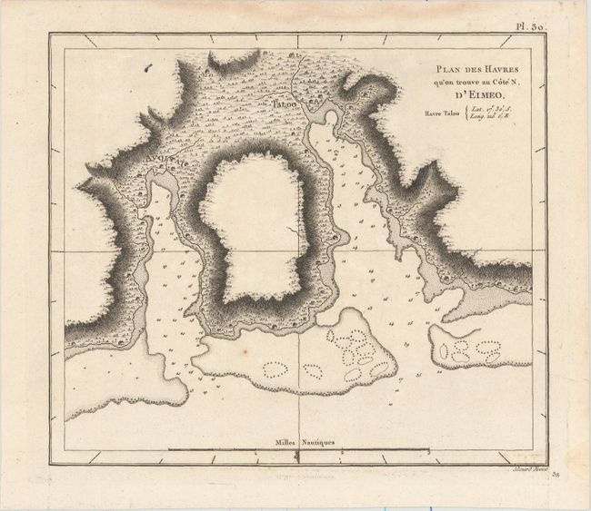
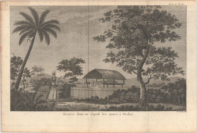
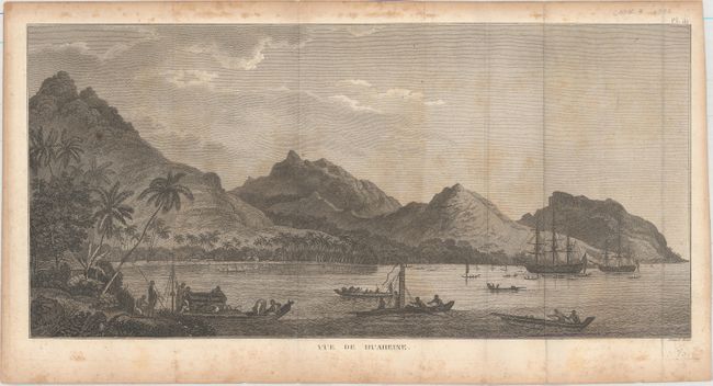
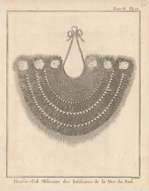
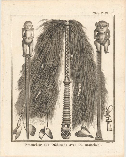
This interesting lot includes one chart and four fascinating illustrations related to the Society Islands. The first sheet zooms in on a harbor on Mo'orea Island, one of the Windward Islands of the Society Islands, near Tahiti. It shows soundings, hazards, and an anchorage, and it features excellent topographical detail and little huts along the coast. Engraved by Benard. The second sheet depicts funeral rites for the Tahitian dead. Engraved by Demonchy. The third sheet, engraved by Benard, is a well rendered view of the harbor of Huahine with numerous native canoes and two sailing ships. The fourth and fifth sheets, both engraved by Benard, present a traditional collar worn by the region's soldiers and a ceremonial fly-whisk, respectively.
A. Plan des Havres qu'on Trouve au Cote N. d'Eimeo, from Troisieme Voyage De Cook, ou Voyage a l'Ocean Pacifique..., circa 1785 (8.8 x 7.6"). Condition: A dark impression on watermarked paper with a few small spots. There are a couple damp stains in the blank margins. (A)
B. Maniere dont on Expose les Morts a Otahiti, from Relation des Voyages Entrepris par Ordre de Sa Majeste Britannique..., circa 1780 (13.1 x 7.9"). Condition: A fine impression issued folding with minor foxing that is only visible in the blank margins. (A)
C. Vue de Huaheine, from Troisieme Voyage De Cook, ou Voyage a l'Ocean Pacifique..., circa 1785 (18.2 x 8.8"). Condition: A nice impression issued folding on watermarked paper with scattered foxing. (B)
D. Hausse-Col Militaire des Insulaires de la Mer du Sud, from Relation des Voyages Entrepris par Ordre de Sa Majeste Britannique..., circa 1780 (6.5 x 8.1"). Condition: On a watermarked sheet with a few unobtrusive spots and a short archivally repaired edge tear that passes the neatline at left. (B+)
E. Emouchoir des Otahitiens avec Ses Manches, from Relation des Voyages Entrepris par Ordre de Sa Majeste Britannique..., circa 1780 (6.6 x 8.1"). Condition: A fine impression on watermarked paper. (A)
References:
Condition:
See description above.