Subject: Papua New Guinea, New Britain, New Ireland, Nendo Island
Period: 1780-87 (circa)
Publication:
Color: Black & White
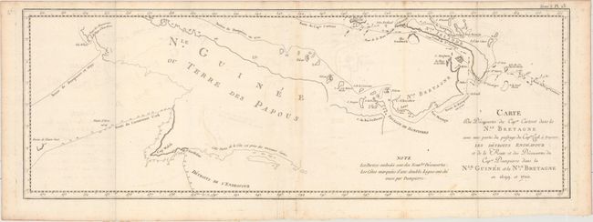
This lot covers several South Pacific islands from Papua New Guinea to Nendo Island, the largest of the Santa Cruz Islands. The charts focus on the areas explored by Philip Carteret in the HMS Swallow beginning in 1766. On the first map, the routes of Captains Cook and Dampierre are also traced.
A. Carte des Decouvertes du Capne. Carteret dans la Nle. Bretagne avec une Partie du Passage du Capne. Cook..., by Captain James Cook, from Relation des Voyages Entrepris par Ordre de Sa Majeste Britannique..., circa 1780 (24.3 x 8.5"). Condition: Issued folding with a few spots of foxing and minor offsetting. (B+)
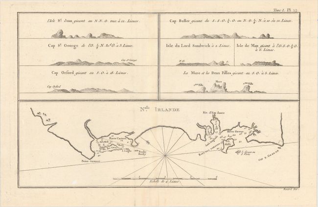
B. Nelle. Irlande, by Cook/Benard, from Relation des Voyages Entrepris par Ordre de Sa Majeste Britannique..., circa 1780 (12.8 x 8.1"). Condition: Issued folding on watermarked paper with a couple faint spots. (A)
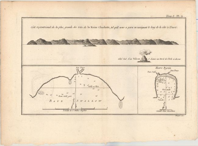
C. Cote Septentrional de la Plus Grande des Isles de la Reine Charlotte..., by Cook/Benard, from Relation des Voyages Entrepris par Ordre de Sa Majeste Britannique..., circa 1780 (11.2 x 6.6"). Condition: There is a faint damp stain at top right and minor offsetting. (B+)
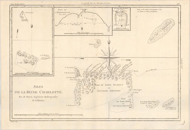
D. Isles de la Reine Charlotte, by Rigobert Bonne, from Voyage du Capt. Carteret, circa 1787 (13.6 x 9.3"). Condition: On a watermarked sheet with faint offsetting and a few tiny rust spots. (A)
References:
Condition:
See description above.