Subject: North Pacific Ocean
Period: 1785-88 (circa)
Publication:
Color: Black & White
Captain James Cook (1728-1779) is best known for his three voyages to the Pacific (1768-71; 1772-75; and 1776-79). His discoveries radically changed the western understanding of the world in the late 18th century. He was the first to circumnavigate and chart New Zealand and provided the earliest European accounts of exploration along the eastern coast of Australia and the Hawaiian Islands. On February 14th, 1779, he was killed on Hawaii after attempting to kidnap the chief of the island.
Many contemporary accounts of Cook’s voyages, including charts and engravings, appeared in the late 18th century. The first official account of Cook’s first voyage was published in 1773 by John Hawkesworth in Volumes II and III of An Account of the Voyages Undertaken by the Order of His Present Majesty for Making Discoveries in the Southern Hemisphere... William Strahan and Thomas Cadell published the first official accounts of the second and third voyages in 1777 and 1784. Accounts of his exploration were subsequently translated into French, German, and Dutch.
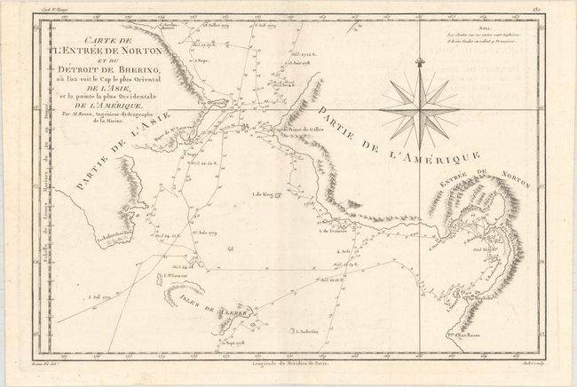
A. Carte de l'Entree de Norton et du Detroit de Bhering, ou l'on Voit le Cap le Plus Oriental de l'Asie, et la Pointe la Plus Occidentale de l'Amerique, by Rigobert Bonne, from Atlas Encyclopedique, circa 1788 (13.8 x 9.3"). Based on the expeditions of Captain Cook, this great map covers the Bering Strait from south of Norton Sound to north of Cap du Prince de Galles and the corresponding coastline of Russia. It shows the Chukotskiy and Seward peninsulas and parts of St. Lawrence Island (here Isles de Clerke). Features include islands, place names, soundings, and hachures representing coastal mountains. The tracks of both the 1778 and 1779 explorations are delineated; Cook having done the former and Clerke the latter after Cook's death in Hawaii in February 1779. Engraved by Andre and decorated with a large compass rose. Reference: Falk #1788-2.
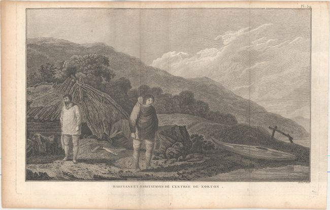
B. Habitans et Habitations de l'Entree de Norton, by Cook/Benard, from Troisieme Voyage de Cook, circa 1785 (14.1 x 8.6"). This lovely engraving depicts a family in Norton Sound with their shelter and kayak. It was based after a drawing by John Webber, one of the official artists who accompanied Cook on his third voyage, and engraved by Benard.
References:
Condition: A
Both are nice impressions issued folding on watermarked sheets. The first sheet has faint offsetting, and the second has marginal toning and soiling.