Subject: Maluku Islands & Sulawesi, Indonesia
Period: 1748-52 (circa)
Publication: Prevost's Histoire Generale des Voyages
Color: Black & White
Size:
6.1 x 8.6 inches
15.5 x 21.8 cm
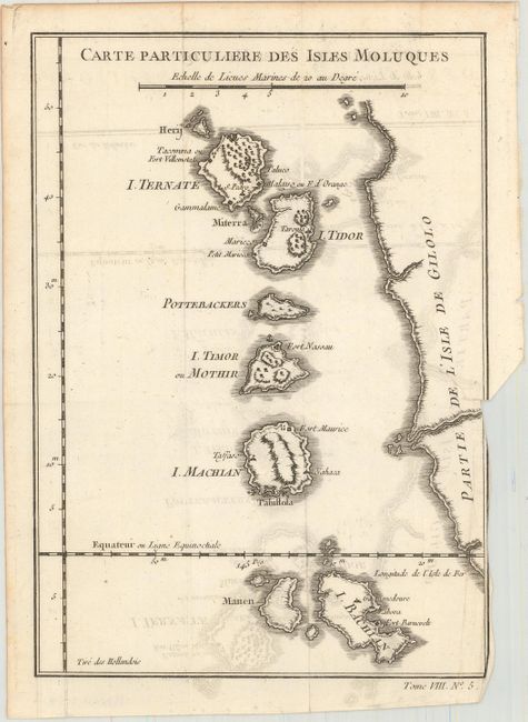
A. Carte Particuliere des Isles Moluques. This delicately engraved map represents the western coast of Irian Jaya and the Maluku Islands, the famous Spice Islands that were the cornerstone of the Dutch trading empire in the East Indies. The map locates the settlements and forts on each island. Condition: A dark impression issued folding with light offsetting. There is a binding trim at bottom right, and an associated binding tear that enters about 1.5" into the image and has been closed on verso with archival tape. (B+)
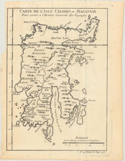
B. Carte de l'Isle Celebes ou Macassar pour Servir a l'Histoire Generale des Voyages. This small, attractive chart depicts the island of Sulawesi (formerly Celebes), situated east of Borneo in Indonesia. There is good topographical detail, and towns and cities are noted, including the island's largest city Makassar (or Ujung Pandang) on the southwest coast. Several smaller offshore islands appear as well. A note in the Gulf of Boni (here called Golphe de Saleyer) indicates that the gulf is filled with sand banks. Condition: A crisp impression issued folding with a hint of offsetting and a binding trim in the upper left margin. (A)
References:
Condition:
See description above.