Subject: East Indies - Indonesia
Period: 1848 (dated)
Publication:
Color: Black & White
Size:
37.6 x 24.5 inches
95.5 x 62.2 cm
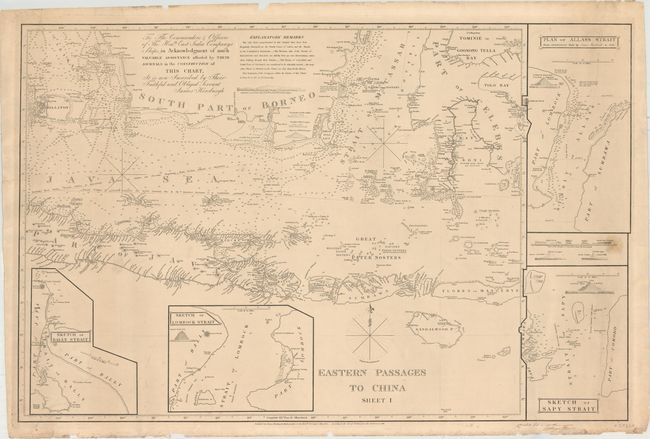
This large, detailed chart was produced by Captain James Horsburgh, hydropgrapher to the East India Company. It covers the southern region of Borneo, the Java Sea, part of Java, Sumbawa, Flores, part of Sulawesi, and all of the smaller Indonesian islands. The chart includes numerous soundings and two possible routes to China. Four insets titled Sketch of Bally Strait, Sketch of Lombock Strait, Sketch of Sapy Strait, and Plan of Allass Strait from Observations Made by James Horsburgh in 1796 surround the map, and small views of the "straits of Salayer from the Westward" are shown as well. Text at top dedicates the chart to the "Commanders & Officers of the Honble. East India Companys Ships." First issued in 1824 with additions to 1848. In manuscript below the bottom neatline is the signature of "C Hagstrom", dated 1854.
References:
Condition: B+
A nice impression with a small stain at right and a tiny tear along the bottom border. Two short edge tears at left that just touch the neatline have been closed on verso with archival material. Numerous other edge chips and tears are confined to the blank margins.