Subject: Southeast Asia
Period: 1943 (dated)
Publication:
Color: Printed Color
Size:
42.4 x 33.5 inches
107.7 x 85.1 cm
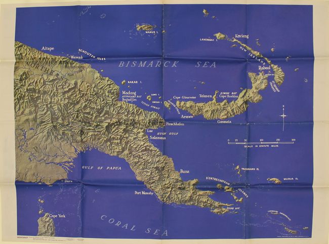
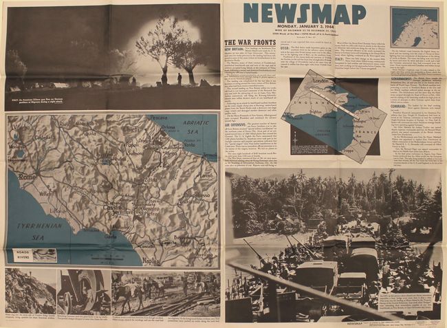
This large-format map covers Papua New Guinea, extending to include the surrounding islands of New Britain, Latangai, and Bougainville. There are only a few place names by the coasts, but the map offers excellent topographical detail with a three-dimensional quality. This map was issued on the verso of the "Newsmap" for Monday, January 3, 1944 which covers the news from December 22-29, 1943 - the 225th week of the war. This issue contains brief text related to the war fronts (including Papua New Guinea) and is accompanied by maps of central Italy and the English Channel. Augmenting the maps are several large photographs depicting various battle locations. Prepared by the Army Orientation Course and issued by the U.S. Government Printing Office.
From 1942-46, the U.S. Army published "newsmaps" to keep American troops updated on the war. These weekly posters were distributed and posted in every American installation in the world and were intentionally more visual than descriptive to help engage and motivate personnel.
References:
Condition: A
Issued folding on a clean sheet with bold color. There is minor creasing adjacent to the folds and several tiny splits at fold intersections.