Subject: Holy Land
Period: 1680 (circa)
Publication: Atlas Minor
Color: Black & White
Size:
21.6 x 18 inches
54.9 x 45.7 cm
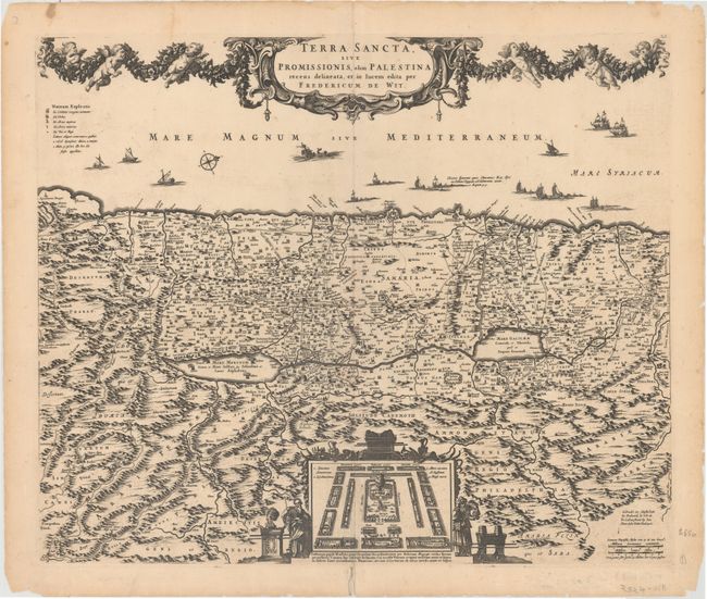
North is oriented to the right on this richly decorative map of the Holy Land. The coast is filled with many different kinds of ships, including one bringing cedar for Solomon's Temple, and another storm-tossed ship with a sea monster that illustrates the Jonah and the whale bible story. The Kishon (Cison) River connects Haifa Bay to the Sea of Galilee. At bottom is an inset of the encampment of the Tribes surrounding the Tabernacle, flanked by Moses and Aaron. The top of the map is decorated with an elegantly engraved cartouche and garland supported by a fleet of putti.
References: Laor #860.
Condition: A
A dark impression with a few tiny spots and short centerfold separations in top and bottom blank margins.