Subject: Russia
Period: 1758-71 (dated)
Publication:
Color:
Size:
11.9 x 7.8 inches
30.2 x 19.8 cm
This lot includes a two-sheet map of the empire of the Russian Empire and a chart focusing on the strait between Novaya Zemlya and the mainland.
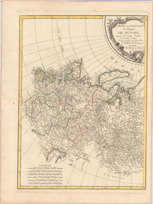
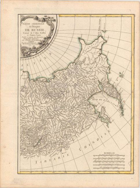
A/B. [On 2 Sheets] Partie Occidentale... [and] Partie Orientale de l'Empire de Russie, Extrait de l'Atlas Russien et d'Autres Cartes..., by Bonne/Lattre, dated 1771, hand color (12.6 x 17.1"). This map of the Russian Empire focuses on the extensive river systems. Towns, political boundaries, and mountain ranges are also shown. Condition: Original outline color on watermarked paper with a couple of small, unobtrusive spots. (A)
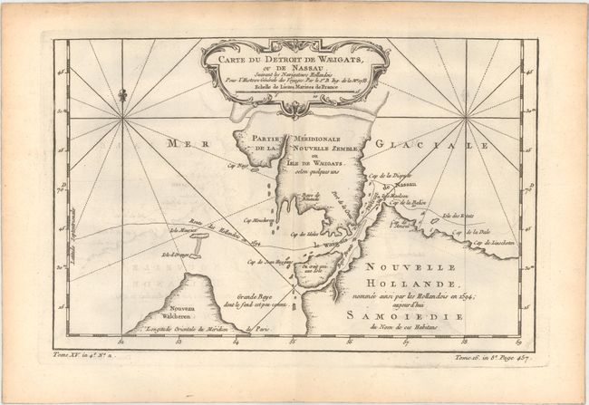
C. Carte du Detroit de Waeigats, ou de Nassau. Suivant les Navigateurs Hollandois pour l'Histoire Generale des Voyages, by Jacques Nicolas Bellin, from Histoire Generale des Voyages, dated 1758, black & white (11.9 x 7.8"). A boldly engraved copperplate map that is centered on the Russian islands of Novaya Zemlya and Pechorskaya Guba, here Nouvelle Zemble and Grande Baye. The detailed chart shows the lower part of the island and mainland. Condition: A dark impression with light offsetting and light toning along edges of sheet. (B+)
References:
Condition:
See description above.