Catalog Archive
Auction 157, Lot 51
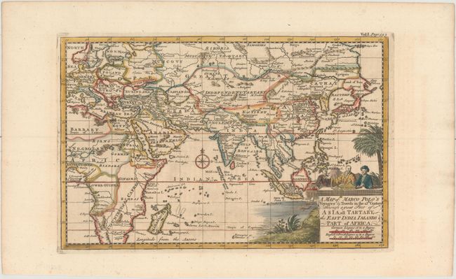
"A Map of Marco Polo's Voyages & Travels in the 13th Century Through a Great Part of Asia, All Tartary, the East India Islands & Part of Africa", Bowen, Emanuel
Subject: Eastern Hemisphere
Period: 1730 (circa)
Publication: Harris' Navigantium atque Itinerantium Bibliotheca
Color: Hand Color
Size:
11.8 x 7.7 inches
30 x 19.6 cm
Download High Resolution Image
(or just click on image to launch the Zoom viewer)
(or just click on image to launch the Zoom viewer)