Subject: Western Europe
Period: 1918 (dated)
Publication:
Color: Black & White
Size:
39.5 x 28.8 inches
100.3 x 73.2 cm
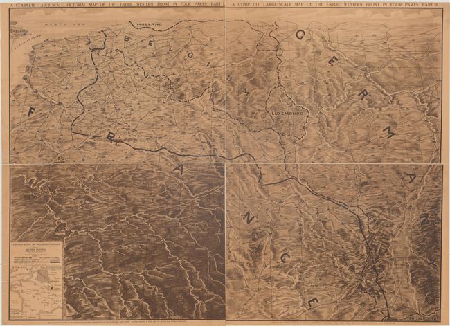
This World War I map was issued in four consecutive weeks of the Mid-Week Pictorial, published by the New York Times, in August 1918. It covers portions of France, Belgium and Germany and depicts towns and cities, rivers, and topography in an unusual pictorial style. Overlaid on top of the map is the western battlefront showing the territory Germany invaded from 1914-1918 with the entrenched line prominently shown in northeastern France. Includes a small inset at bottom. Drawn by Otto Kurth. Issued on four sheets that have been backed with a single sheet of linen and folds into the size of a single sheet (21 x 15").
References:
Condition: B+
Toned with just a bit of surface soil and a tiny worm track at bottom left, not affecting image.