Subject: Low Countries
Period: 1676 (published)
Publication: A Prospect of the Most Famous Parts of the World
Color: Hand Color
Size:
21 x 16.4 inches
53.3 x 41.7 cm
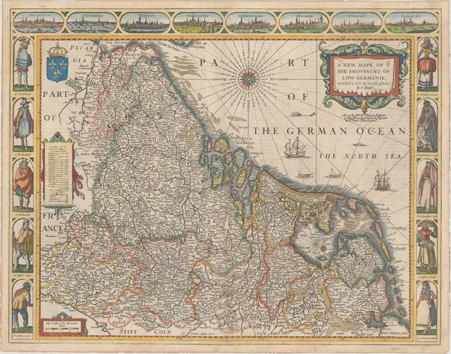
A stunning carte-a-figures map of the Low Countries. The vignettes of Amsterdam, Antwerp, Ghent, Middelburg, Groningen, Zutphen, Utrecht, and Atrecht fill the top border. The side panels illustrate the social hierarchy of society with superb illustrations of a gentleman, a "Brabander," a Hollander, a fisherman, and a countryman with their respective female partners. The map is filled with scores of place names, a table listing the number of cities and villages in each province, a lovely compass rose, and numerous ships in the North Sea. The English text on the verso has a description of the region, people and history. The imprint of Bassett and Chiswell appears below the title.
References: Shirley (BL Atlases) T.SPE-2f.
Condition: B+
A crisp impression on watermarked paper with professional repairs to a long centerfold separation at bottom and a small hole along the centerfold with small loss of image. There are additional professional repairs to minor chips and tears confined to the blank margins.