Subject: North Sea
Period: 1668 (dated)
Publication: De Zee-Atlas, Ofte Water-Weereld…
Color: Hand Color
Size:
21.4 x 17.5 inches
54.4 x 44.5 cm
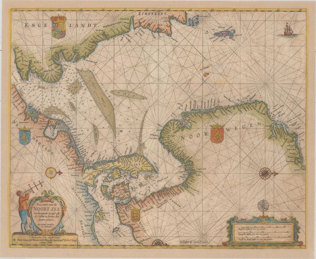
This splendid sea chart covers the North Sea. It is oriented by five exquisite compass roses with north to the right so that the coastlines of England and Scotland are along the top, and the Netherlands, Denmark, and Norway with a bit of the Baltic is at left and along the bottom. The two smaller compass roses show the deviation from magnetic north. The map provides excellent navigational information including soundings and the location of fishing banks. Beautifully embellished with the arms of Britain, Holland, Sweden, and Norway, a sailing ship, and two fine cartouches.
Pieter Goos was one of Amsterdam’s most prominent publishers of nautical charts. The reputation of his firm was matched only by that of the publishing houses of Blaeu and van Keulen and his maritime atlas of the world was one of the most complete sea atlases published prior to the appearance of Van Keulen’s Zee-Fakkel in the 1680’s.
References: Putnam, Early Sea Charts, pp. 99-100; Tooley (MCC-70) #290.
Condition: B
The sheet has been fully and professionally remargined with a small portion of the neatline at top and the neatline and a small portion of the cartouches at bottom left and right replaced in facsimile. There is light scattered foxing and soiling, as well as a few small worm tracks.