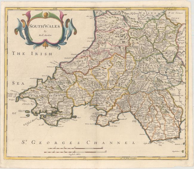
Subject: Southern Wales
Period: 1695 (circa)
Publication: Camden's Britannia...
Color: Hand Color
Size:
16.9 x 14.1 inches
42.9 x 35.8 cm
This beautifully engraved map of South Wales begins near Aberystwyth and extends to include the entirety of the southern coast. The map depicts the mountainous topography, and each county is named and outlined. Embellished with a bold title cartouche and two distance scales.
Morden was one of the first English cartographers to show longitudes measured from the meridian of St. Paul's Cathedral (shown in degrees at the bottom of the map) and time in minutes measure locally from the sun (shown at the top in Roman numerals). The roads on his maps are based on Ogilby's earlier survey. The Britannia was first published by historian William Camden (1551-1623) in 1586. After the publication of the final edition of Britannia in 1637, the work was not published again until 1695 when Gibson revised and translated the text from the original Latin. He included fifty maps, mostly of the English counties, prepared by Robert Morden, replacing the outdated maps of Christopher Saxton.
References: Shirley (BL Atlases) T.CAMD-5a.
Condition: A
A nice example on watermarked paper with faint offsetting and some minor creases and tears in the blank margins.