Subject: Wales
Period: 1637 (published)
Publication: Camden's Britannia
Color: Hand Color
Size:
11.9 x 9.8 inches
30.2 x 24.9 cm
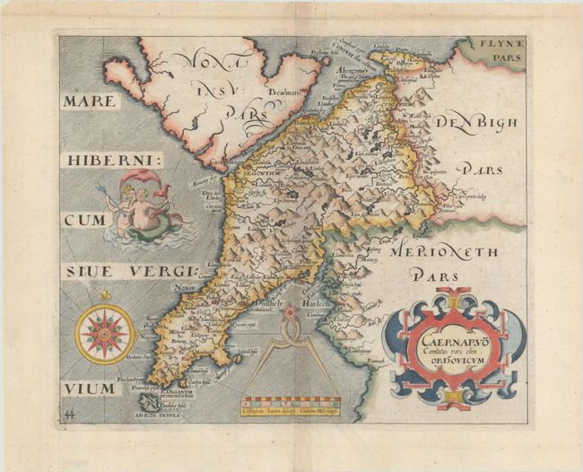
This attractive map of the Caernarvon peninsula graphically depicts the rugged topography of the region and is centered on Mt. Snowdon. Locates numerous towns and villages, especially along the coastline, with forests and lakes and mountains filling the interior. The map is elaborately decorated with a scene of Neptune embracing a woman, a divider and compass rose. Saxton and Hole's imprint appears below the distance scale. Published in the 1637 edition of Camden's Britannia, with the addition of a plate number on the map.
References: Shirley (BL Atlases) T.CAMD-1e.
Condition: A
A crisp impression on watermarked paper with attractive color and a few minor creases.